After a Denver7 viewer asked for a Follow Up on a study on Cottonwood Pass — sometimes used as an undesignated alternate route when Glenwood Canyon is closed — we asked CDOT for an update.
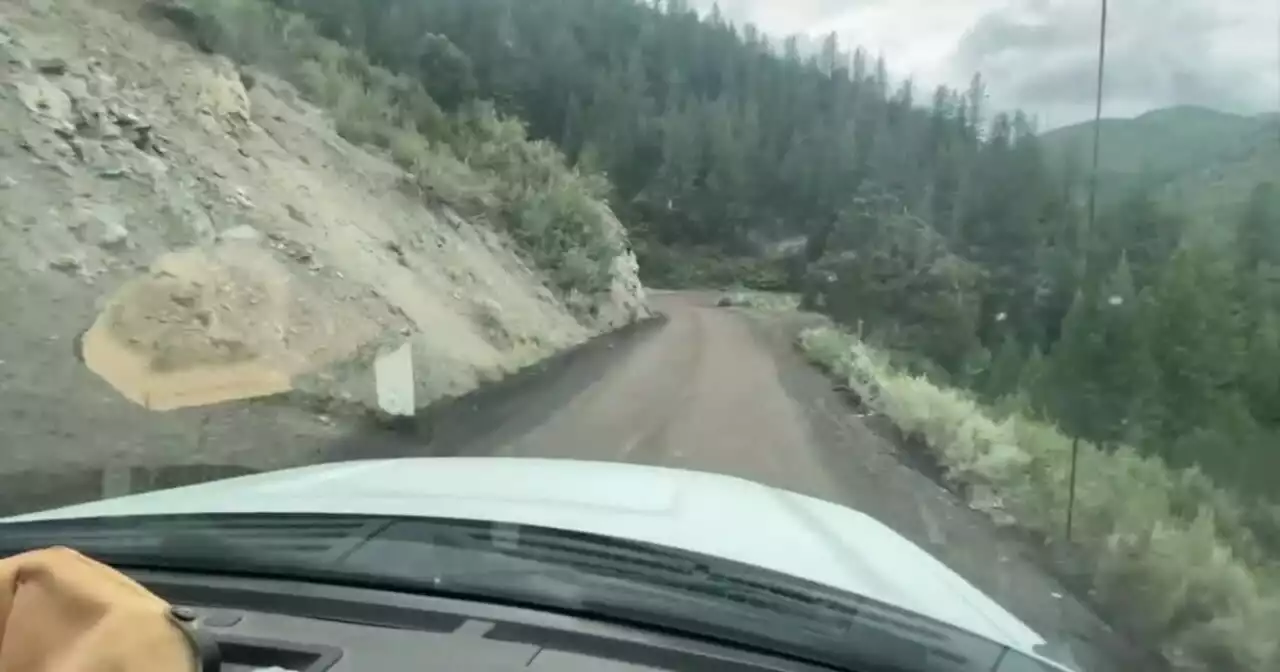
The Colorado Department of Transportation is continuing its study on the future of Cottonwood Pass, a rural mountain county road in Eagle and Garfield counties sometimes used by unknowing drivers as an undesignated alternate route when Glenwood Canyon is closed.
As some quick background: The issue with slides in the canyon is a familiar one — that section of Interstate 70 was fully closed for about two weeks in 2021 for the same reason, but on a much larger scale than last week's. In some places, debris and mud was stacked 12 feet high above the road after the land, weakened by the 2020 Grizzly Creek Fire, gave way in several sections.
The subsequent issues impacted all drivers — both travelers and the locals. People who live nearby and use the road daily found themselves in standstill traffic jams. And drivers unfamiliar with Cottonwood Pass on the Eagle County northern side found an unpaved road with sharp turns and narrow and steep sections. Cars rolled off the roadway. Speeding was an issue. Scared drivers were paralyzed in the middle of the road.
Cottonwood Pass: The secret, unsafe shortcut around I-70 shutdown The traffic and issues eased once Glenwood Canyon reopened to traffic. But officials knew it was only a matter of time before this same problem reared up again. They had actually been looking at improving the pass road, especially the Blue Hill stretch, long before the 2021 closure of Glenwood Canyon, CDOT said.
New push to improve Cottonwood Pass Both impacted counties and CDOT created this project with the understanding that Cottonwood Pass is not an endorsed detour route when Glenwood Canyon is closed. However, the pass is a vital connection for local residents who need to travel between Gypsum and Colorado Highway 82 for work, school, medical care and more, CDOT said.
The pass road had three ways to connect to Colorado Highway 82 on the south side: Catherine Store Road, County Road 113, and a combo of County Road 114 and 115. Both of the latter had"significant challenges and constraints," according to CDOT, so Catherine Store Road was determined as the best route to analyze.
Canada Latest News, Canada Headlines
Similar News:You can also read news stories similar to this one that we have collected from other news sources.
 Lynwood barricade situation prompts lockdown at Sandridge Elementary School: officialsChopper 7 was over Glenwood Dyer Road as police investigated.
Read more »
 Activists, elected officials to rally demanding Gov. Newsom shut down Aliso Canyon facilityThe rally will take place on Tuesday, Aug. 22 at 6 p.m. at Rinaldi Street & Tampa Avenue in Porter Ranch.
Read more »
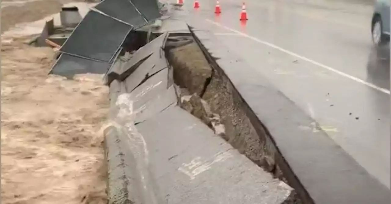 Video Shows Sand Canyon Road Collapsing After Heavy Rainfall in CaliforniaHeavy rainfall caused part of Sand Canyon Road in Santa Clarita, California, to collapse as result of Hilary, which has been downgraded.
Read more »
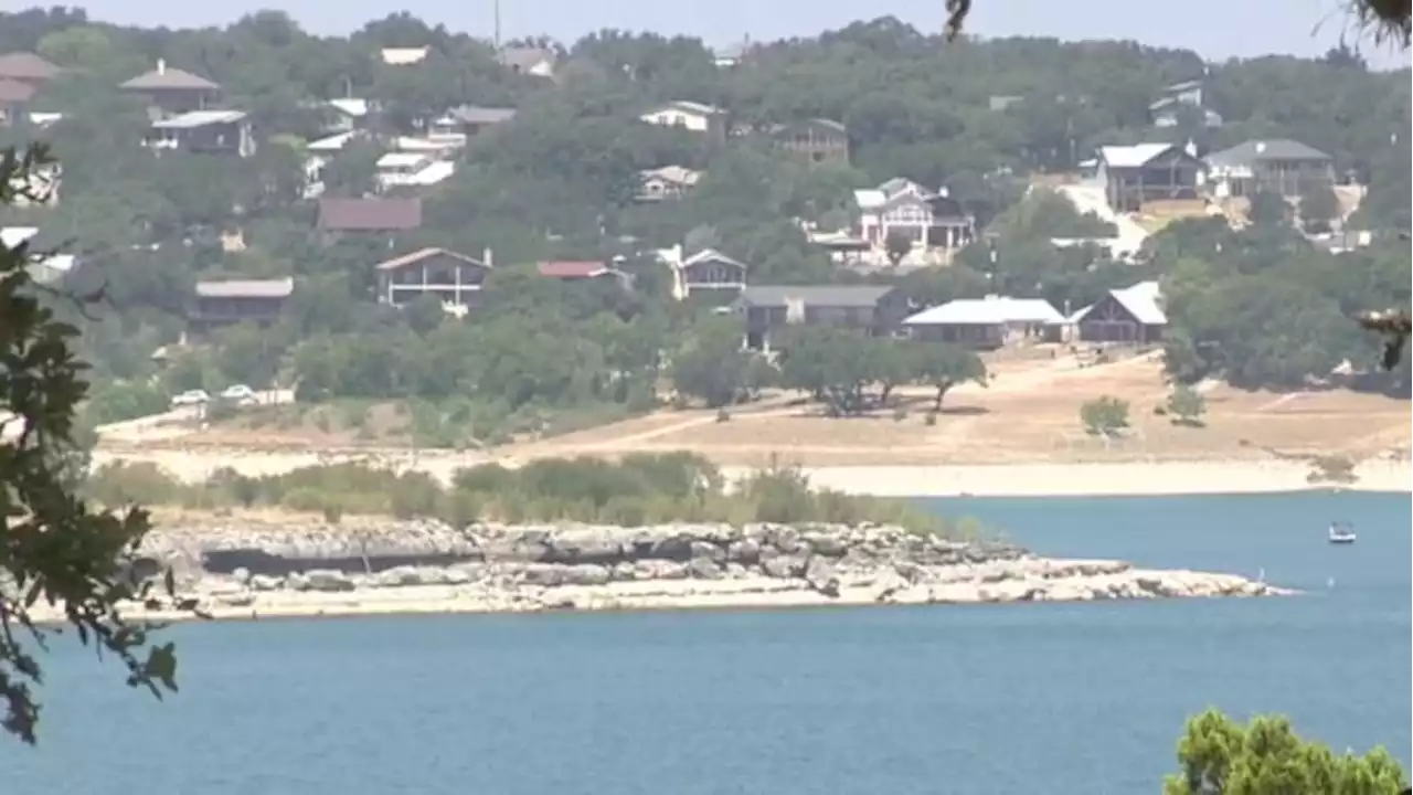 Low water levels at Canyon Lake prompt closure of boat rampDue to dropping lake levels, Potters Creek Boat Ramp 21 at Canyon Lake will close on Tuesday, the U.S. Army Corps of Engineers said.
Read more »
 Pakistan launches dramatic rescue mission to save children trapped in cable car over canyonA rescue mission in northwest Pakistan has rescued two out of six children that have been trapped in a cable car hanging hundreds of feet in the air.
Read more »