
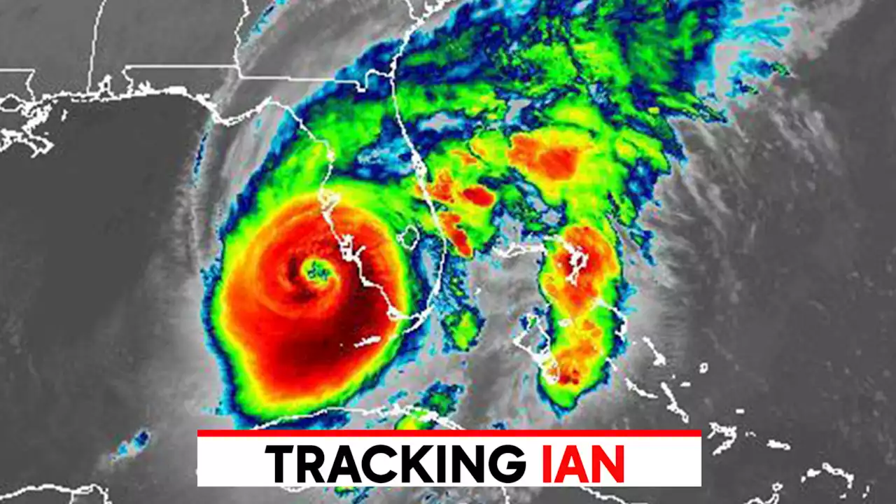
The storm was approaching Category 5 strength as it headed toward the coast -- though track, timing and intensity could still change.
Significant and possibly devastating impacts could extend far from the center of the storm. The entire Florida Peninsula is under either a hurricane or tropical storm warning. Hurricane warnings have been issued for Tampa and Fort Myers, extending south to Chokoloskee.As Ian moves north, tropical storm force winds could reach coastal Georgia and South Carolina. Tropical storm watches have been issued for Savannah and near Charleston.
Storm surge warnings are in effect for a large portion of the west coast of Florida, from Cedar Key to the southwest corner of the state.Flooding from torrential rains is also possible inland. The highest rain totals are expected from Venice to Sarasota to the Tampa Bay area, where up to 20 inches of rain is forecast. Up to 2 feet is possible in some areas.
Canada Latest News, Canada Headlines
Similar News:You can also read news stories similar to this one that we have collected from other news sources.
 Hurricane Ian live radar: Latest maps, projections and possible path as storm approaches FloridaIan, which is currently in the Gulf of Mexico, is forecast to make landfall on Florida's western coast on Wednesday between 1 and 6 p.m.
Read more »
![]() Hurricane Ian tracker: Latest maps, projections and possible pathsHurricane Ian is currently forecast to make landfall in Florida as a Category 3 storm on Wednesday between 4 and 8 p.m. somewhere between Tampa and Fort Myers.
Hurricane Ian tracker: Latest maps, projections and possible pathsHurricane Ian is currently forecast to make landfall in Florida as a Category 3 storm on Wednesday between 4 and 8 p.m. somewhere between Tampa and Fort Myers.
Read more »
 Hurricane Ian latest path: Winds near CAT 5 as storm approaches FloridaHurricane Ian's winds increased to 155 m.p.h. as the storm rapidly intensified ahead of landfall in Florida where catastrophic damage was feared from storm surge, winds and flooding.
Read more »