
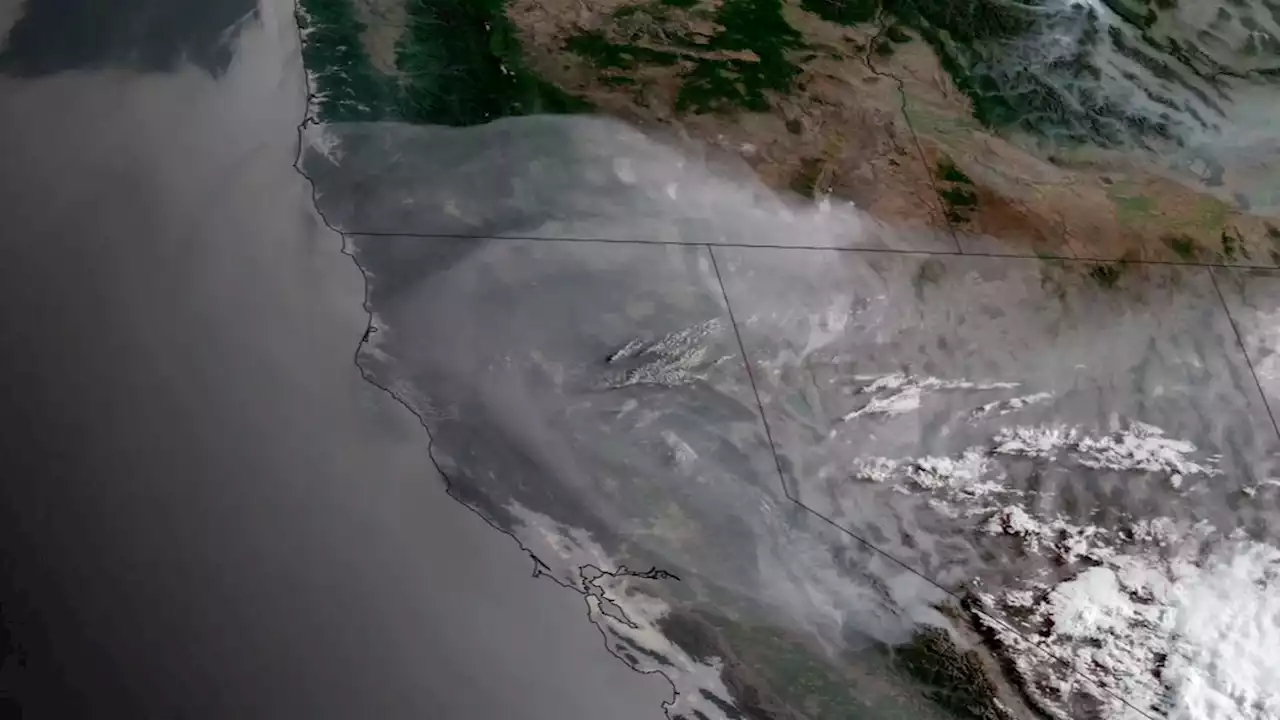
Dramatic satellite imagery reveals the scope of the blaze — now as large as Manhattan Island and burning out of control. OakFire California
California's Oak Fire, as seen by the Landsat satellite on Sunday, on July 24, 2022. The image is rendered in a simulated 3D view. So far, California's Oak Fire blazing near Yosemite National Park has burned through through 14,281 acres — an area equivalent to the size of Manhattan Island. That makes it California's biggest wildfire this season.
. The cause of the blaze, which began in the afternoon of July 22 about two miles northeast of Mariposa, is under investigation. The blaze exploded in intensity and size on Saturday. Here's what that looked like from space, as seen by the GOES-16 satellite:
Canada Latest News, Canada Headlines
Similar News:You can also read news stories similar to this one that we have collected from other news sources.
 California’s Oak Fire Near Yosemite Spreads RapidlyThe OakFire burning near YosemiteNPS, is currently the largest active fire in California. NOAA satellites are monitoring the blaze, which is being fueled by dried vegetation and extended drought conditions. Learn more in today's EarthFromOrbit:
Read more »
 Oak Fire: Crews reach 39% containment, acreage grows to 19,156Crews have begun to gain containment on the Oak Fire in Mariposa County that has forced more than 6,000 people to leave their homes.
Read more »
 Oak Fire, 42 percent contained, claims 135 structures, burns 19,000 acresThe Oak Fire in Mariposa County has charred nearly 30 square miles (19,200 acres) of trees and brush, with 42 percent containment.
Read more »
 Fires, floods and drought: Scenes of extreme weather from spaceSatellite imagery reveals a superheated planet that’s ablaze, swamped and dessicated.
Read more »
 Oak Fire: Crews reach 45% containment, acreage grows to 19,208The Bay Area's source for breaking news and live streaming video online. Covering San Francisco, Oakland and San Jose and all of the greater Bay Area.
Read more »