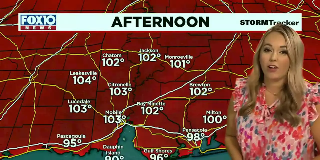
Feels-like temperatures could get up to 115 degrees.
, meaning feels-like temperatures could get up to 115 degrees. Daytime highs will also be maxing out in the triple digits. Mobile Regional’s previous record high is 99 degrees. Rain chances will stay away, with plenty of sunshine this afternoon.
We’re not only tracking the heat here on the Gulf Coast, but we’re also tracking the tropics! We’re monitoring three areas in the Atlantic and the Caribbean. Two tropical waves in the Central Atlantic. One has high chances of development, and one has low chances. We will continue to monitor over the next week. Franklin is a Tropical Storm in the Caribbean. It is expected to impact areas near the Dominican and Haiti, before pushing into the Central Atlantic.
The heat and humidity continues into the week ahead. Triple-digit daytime highs are possible heading into the weekend, but high humidity will have us feeling even hotter! Be cautious and limit your time outside! Rain chances will be minimal. Rip current risks are moderae today but will drop to low by the weekend, but still be careful if spending time at the beach.
Rain chances and temperatures in the 90s return next weekend when the area of high pressure influencing our forecast pushes west.