National Hurricane Center data for New York City shows development happening in at-risk areas, even as climate change brings more frequent and intense storms.
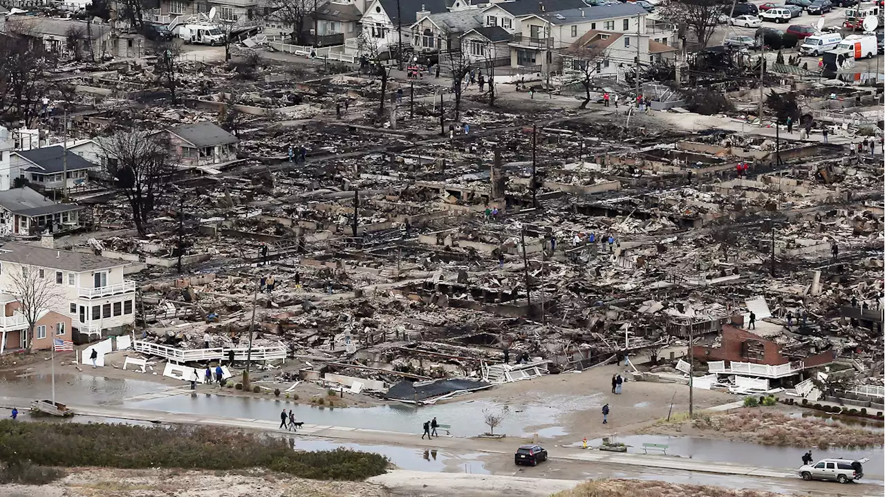
People walk near the remains of burned homes after Hurricane Sandy in the Breezy Point neighborhood of the Queens borough of New York City on Oct. 31, 2012. Over 50 homes were reportedly destroyed in a fire during the storm.People walk near the remains of burned homes after Hurricane Sandy in the Breezy Point neighborhood of the Queens borough of New York City on Oct. 31, 2012. Over 50 homes were reportedly destroyed in a fire during the storm.
"People in affordable housing are more exposed to flooding, and they have the least resources to deal with it," said Bernice Rosenzweig, a professor of environmental studies at Sarah Lawrence College. Owner Nicholas Padilla has come to dread the rain. At any given time in his dirt basement, Padilla can dig about six inches deep and hit water.
Several parts of New York City's waterfront, including the neighborhoods of Greenpoint and Williamsburg in Brooklyn, are booming with development. The local community boardwere added to both waterfront areas in the past decade — many in new high-rise towers right along the East River. Despite sea level rise, this property ranks among the most valuable in the city — with median sales around $1.2 million last year.